
Utilities
THE POWER OF MAPS
Are you ready to make a difference?
We know how vital remote assets are, and the huge investment involved.
40% Non-Service
A Field Worker spends on average 37-40% of their working week on non-service-related tasks.
15% Non-Service
With Maptaskr your Field Workers now only use 15% of their time on non-service-related tasks instead of 37-40%.
25% Extra Productivity
You just got 25% extra productivity per Field Staff per week = Quick ROI.
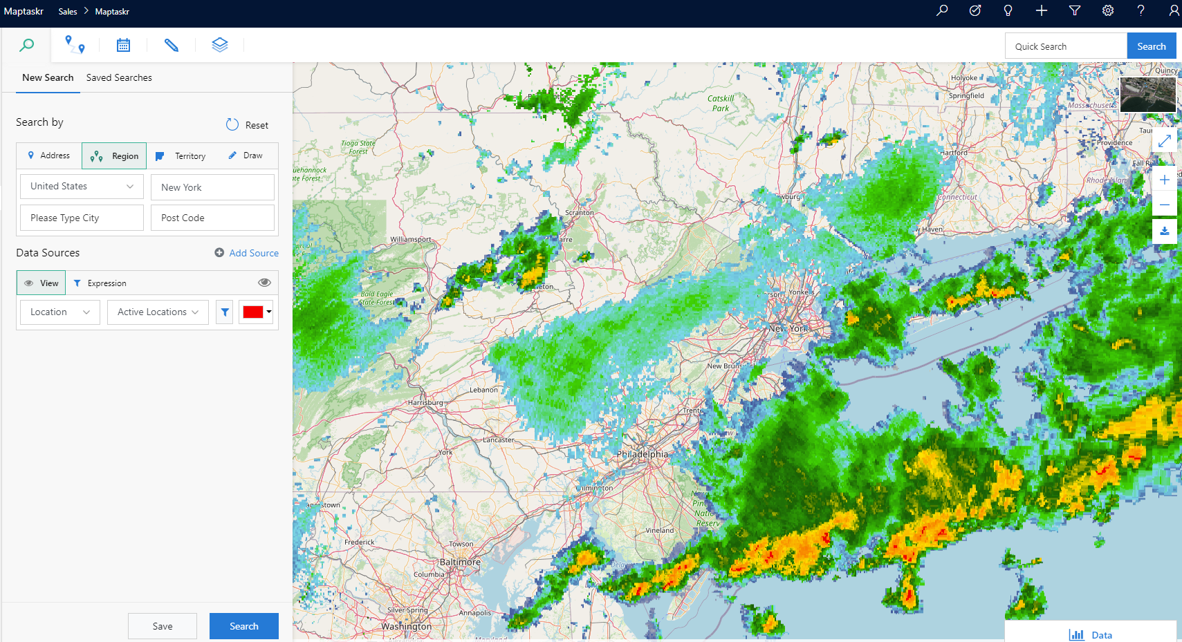
BE INFORMED BEFORE SENDING SOMEONE ONSITE
Use the latest technology to help you service and increase productivity.
See weather forecasts, surroundings, and any potential hazards all on a map!
Optimize Your Field Operations
A Field Worker spends on average 37-40% of their working week on non-service-related tasks.
Be Confident
When to send a field engineer or not can be a decision based on high resolution, aerial imagery, and enterprise data to provide an unprecedented level of accuracy.
Be Proactive
When to send a field engineer or not can be a decision based on high resolution, aerial imagery, and enterprise data to provide an unprecedented level of accuracy.
Take Action
Plan routes more accurately and reduce factors such as downtime or preventative maintenance. Use a map combined with all the relevant information to deploy crews during regular maintenance or critical events by giving your team the exact geocoordinates and current information about the sites and potential obstructions.

Communicate with your customers
Communication with your customers, whether they are service announcements or planned outrages in specific areas, can be challenging. With Maptaskr, you can identify the area you would like to target, select the customers/contacts, and communicate easily.

Geofenced zones
Collaborate with colleagues and external customers by sharing maps; create Geofencing Areas, job site security, and employee clock-in/clock-out.

1- Click Actions
Create and trigger custom workflows to automate different business processes. Easily manage tasks, view customer records, book a meeting, route plan, and one-click “word order”.

Aerial data
Bring in aerial imagery direct to Dynamics 365 for accurate ground intelligence. Make informed planning and maintenance decisions before you visit the site. Support services like MetroMap and Nearmap. Own drone/photo data and weather service.

Visualise infrastructure data
Visualise Dynamics 365 and existing infrastructure data using Maptaskr. Easily share your infrastructure data with Dynamics users. Enable your field staff to take actions by providing them with relevant business-critical data, and put your Dynamics 365 data in context with ArcGIS data.
Layers
Does Weather have a big impact on your field workers’ tasks? What about fires? Show third-party layers together with your data for forecasted weather, drought prediction, railroads, radar, and many more services.